blah blah blah
Blueberry Mountain
Length: 6.3 miles out-and-backDifficulty (click for info): Moderate
Elevation Gain: 1360 feet (+50 feet on return)
Rating (click for info): 6/10
Elevation: 2662'
Prominence: 52'
Driving Directions:
Trailhead is on Blueberry Mountain Road in Benton, NH. To get there, take Lime Kiln Road from the north side of Rt. 25, 8.8 miles northwest of Rt. 118 and 4.9 miles east of Rt. 10. Drive 1.5 miles down Lime Kiln Road, then continue straight onto Page Road (Lime Kiln Road bends left). Drive 0.8 miles, then turn left onto Blueberry Mountain Road (signed for the hiking trail). Drive less than 0.1 miles and park before the gate, on the roadside. Click here for a Google map.
About the Hike:
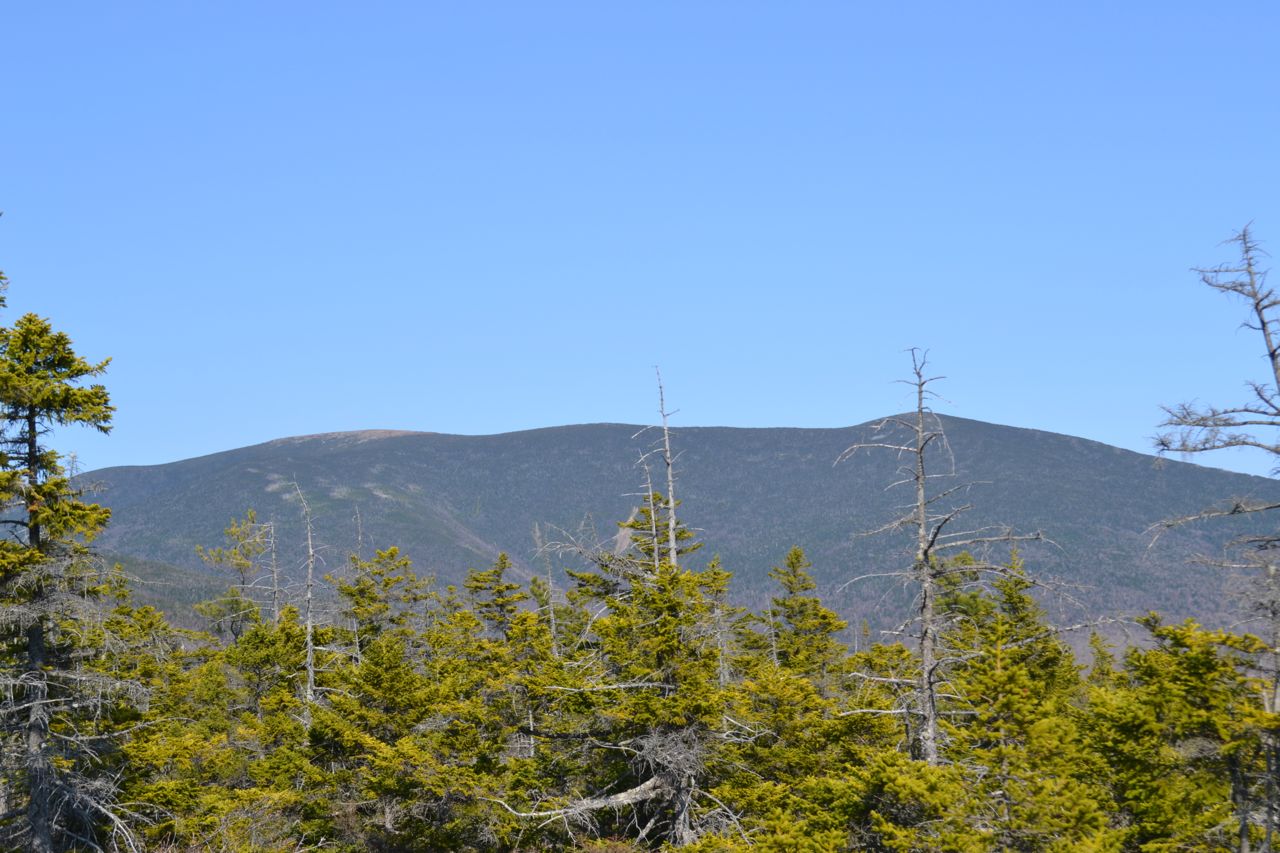
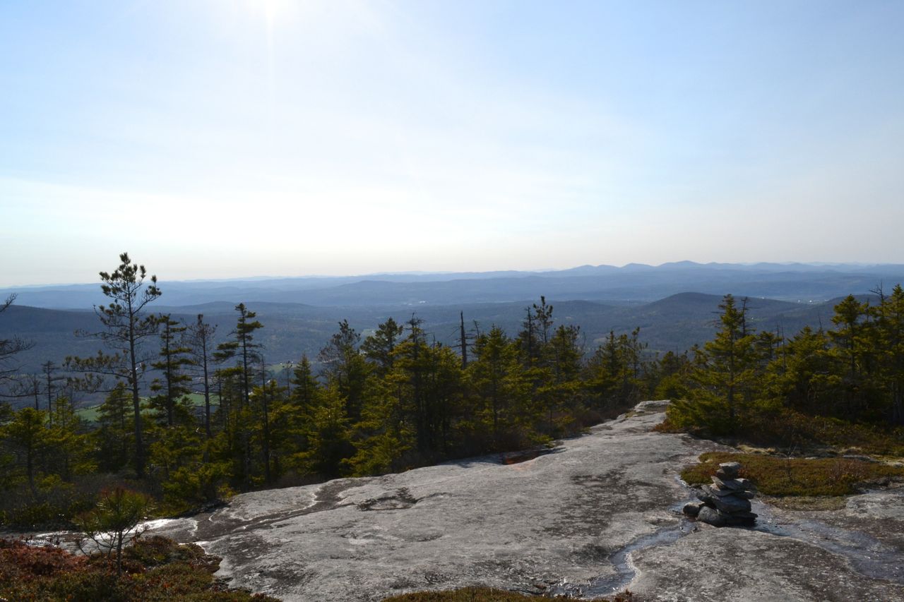
Blueberry Mountain is a small bump on the side of Jeffers Mountain, in the Benton Range. Scattered ledges across the mountain provide decent views in different directions. The most popular route ascends the mountain from the east side, but the best views are found on the west ledges. The summit itself provides very limited views, so we recommend a hike to the west ledges on the seldom-used west side of Blueberry Mountain Trail. The trail, although not often hiked, is easy enough to follow, so long as you are careful and have good directions.
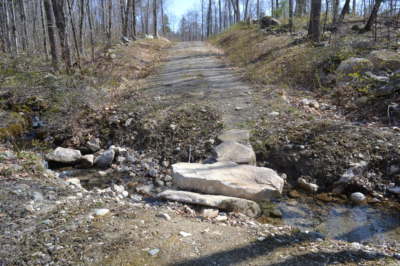
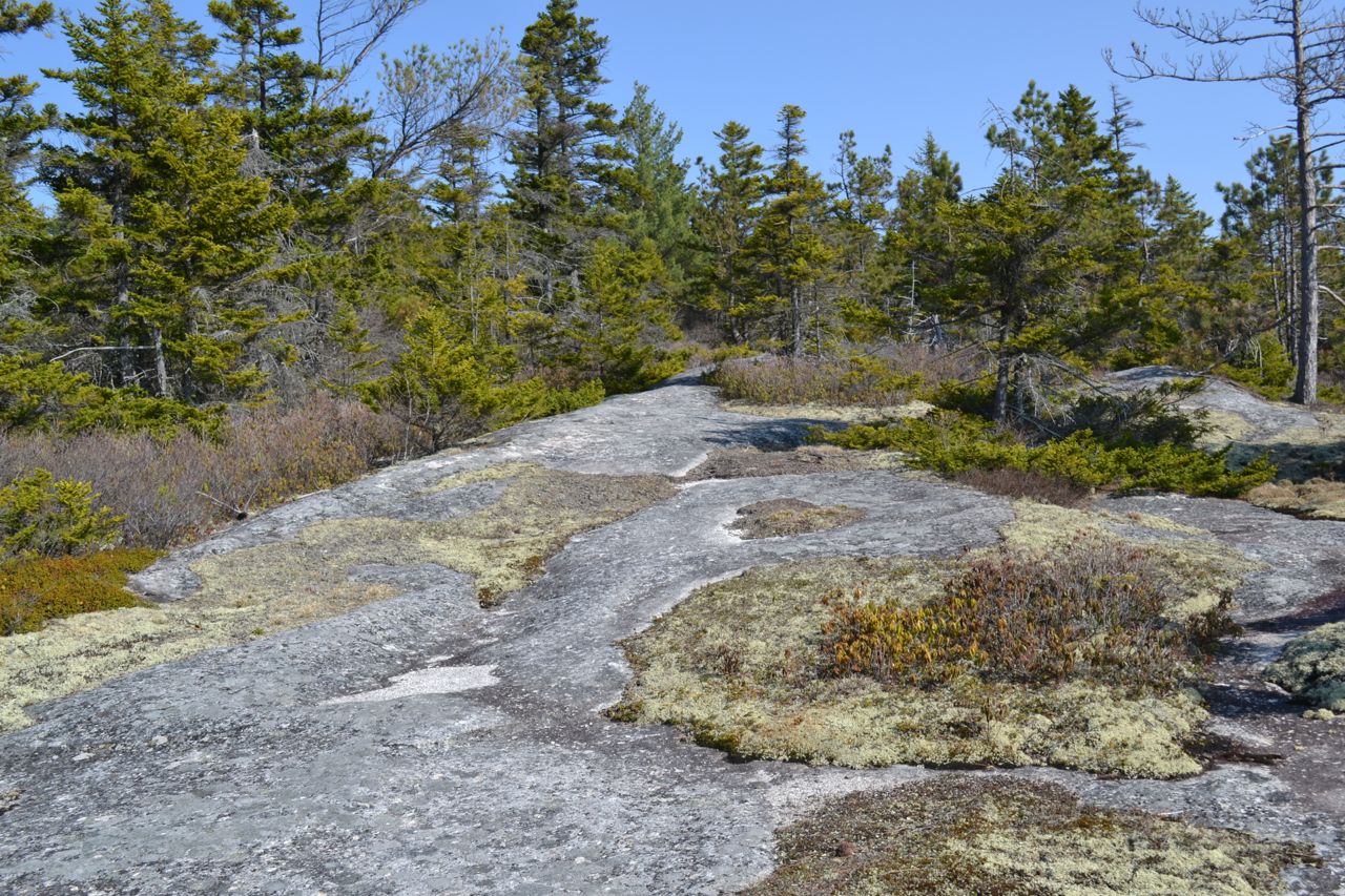
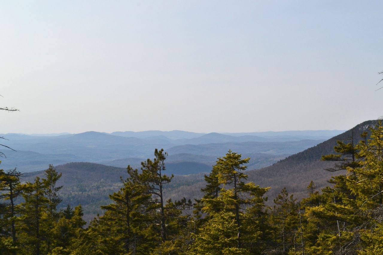
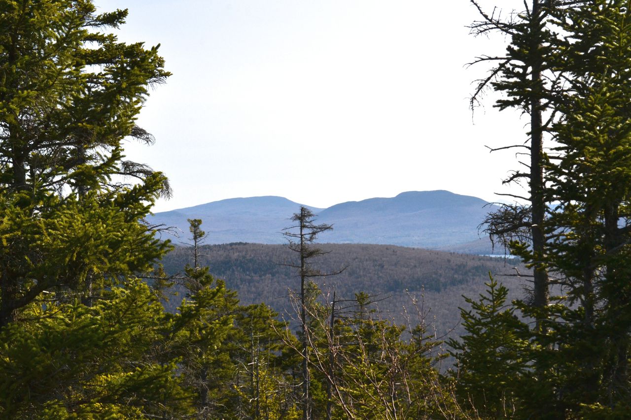
The hike begins on the gated Blueberry Mountain Road. After a half mile walk on this dirt road, turn right at a sign to follow the first of several logging roads. Just after, another road diverges to the right; stay straight. The path climbs slowly and crosses a few seasonal streams. Soon, you will pass the first of many logged areas and the logging road will end, 0.5 miles from Blueberry Mountain Road. Turn left to face two more logging roads; follow the right fork onto a more overgrown logging road. In just over 0.1 miles, another logging road leaves on the left; continue straight. Then, in 0.2 miles, bear left as the trail leaves the logging roads. It continues past clearings on a grassy path lined with birch trees, crosses a brook, then begins to climb. It ascends moderately through the forest alongside still more logged areas. At the end of the steepest climbing, the trail swings onto the first of the ledges. The path winds through scenic areas of moss-carpeted rock and small conifers. Once it reaches the higher, more open ledges, the views open up. As you walk over the rock, look behind you for restricted views into Vermont, north to Black Mountain and Sugarloaf Mountain, and south to Smarts Mountain and Mt. Cube. The views come to their climax at a point on the trail where you have a wide and minimally blocked view to the west. Your hike can end here (about 1.2 miles from the last logging road), but if you have time and wish to see an up-close view of Mt. Moosilauke or are hiking Blueberry as part of the 52-with-a-view list, you can continue to the summit. Continue to watch carefully for markings as the trail follows the ledges as much as possible over gentle terrain. It swings left, then back to the right, passing a restricted view of the more northern peaks in the Benton Range, including Black Mountain, Sugarloaf, and Jeffers Mountain. In about 0.3 miles from the best view ledge, as the trail crosses less open ledges, look for a side path on the left that leads up a short distance to the summit, where there is a minor viewpoint of Mt. Moosilauke. Slightly better views of Moosilauke can also be obtained by continuing down the other side of Blueberry Mountain Trail for about 0.1 miles to more open ledges.
Printable directions page